Surveying and mapping services
Base maps, topographic and strip maps; land readjustment, setting-out, GNSS surveys, as-built and industrial measurements.
Every project starts with an accurate map. We measure every detail on site with high precision and deliver digital maps that are ready for design, whether for a single parcel or a line kilometres long. Our team works with GNSS receivers, total stations and up-to-date software in line with the Turkish large-scale mapping regulation.
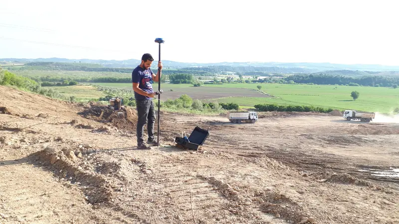
Map production
Digital base maps
Large-scale digital maps showing terrain, buildings, utilities and current land use, with a modelled topography.
Topographic (plan-elevation) maps
Maps containing elevations and all site details as a base for architectural and engineering design.
Strip maps
Corridor surveys along the axis of roads, canals, tunnels and power lines.
Bathymetric maps
Underwater topography from echo-sounding surveys of the sea or lake bed, for jetties, ports and reclamation projects.
As-built surveys
Surveys and drawings at completion that show conformity with the design and feed the facility's information system.
Zoning & parcel work
Land readjustment (Article 18)
Merging plots within the zoning boundary, re-dividing them into blocks and parcels that follow the zoning plan, distributing them to right holders and preparing them for registration.
Subdivision and amalgamation
Splitting a parcel or merging several parcels in line with the plan and zoning rules.
Dedication to road, green area or park
Dedication of the parts of a parcel falling into roads, parks or green areas, usually required before a building permit.
Expropriation maps
Expropriation plans and per-parcel area calculations for roads, power lines, urban renewal and public investments.
Setting-out
Transferring zoning, building, road and landscape designs accurately onto the ground from fixed control points.
Building permit process
Building setting-out project
A signed project showing the building's position, setbacks, corner coordinates and reference points in the national coordinate system.
TUS – Technical application responsibility
Preparing site, offset and level sketches and acting as the responsible surveying engineer during construction.
Referenced sketch
A document showing the exact boundaries of the plot with coordinates, to scale.
Facade survey
Measuring an existing building to redraw its facades, plans and sections.
Engineering surveys
GNSS surveys and network adjustment
Establishing control networks with satellite positioning, detail surveys and adjustment computations.
Industrial measurements
Positioning and control surveys for precision installations such as machinery, transformers, conveyors and tanks.
Mining surveys
Stockpile volume measurement and planning of working areas in quarries and mines.
Profiles, cross-sections and earthwork volumes
Long and cross sections for roads, canals, streams and power lines; cut-and-fill volumes and progress measurements.
Positioning
Precise determination and reporting of the coordinates of a property, structure or equipment.
Work it out in advance
Area from coordinates
Type or paste corner coordinates from NetCAD or Excel and get area (m², dönüm, hectares), perimeter, edge lengths and a drawing instantly.
Open toolCadastre fee calculator
Estimated fees for setting-out, change of use, amalgamation and other licensed cadastre work, based on the official 2026 / 2. dönem tariff.
Open toolCommon questions
What is the difference between a base map and a topographic map?
A base map shows the current state of a wider area and is usually produced for municipalities or institutions. A topographic (plan-elevation) map is prepared for a specific parcel or project site, with elevations, as a base for design.
How long does a survey take?
A single-parcel topographic survey or setting-out is usually delivered within a few days. For large areas and linear projects we confirm the schedule after a site visit.
In which formats do you deliver?
Mainly NetCAD and AutoCAD (DWG/DXF), plus coordinate lists and signed printouts if required.
We can help with the other stages too
Licensed Cadastre (LİHKAB)
Setting-out, change of land use, amalgamation, easements and on-site boundary indication as licensed office no. 3106-310.
Details 03Energy Projects (Solar & Wind)
Site selection, permits, zoning, expropriation and surveying for licensed and unlicensed solar and wind plants.
Details 04Construction & Contracting
Refinery and storage facilities, soil surveys, steel structures, raft foundations, installation, blasting & painting, electrical and automation.
Details 05Technical Consultancy
Design and construction supervision in industrial zones and OSBs, with an expert team of architects and engineers.
DetailsLet's talk about your project
Send us your parcel details or describe the job; we will reply with time and price the same day.